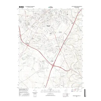
2016 Map of Bowling Green South
USGS Topo · Published 2016About this map
Bowling Green dominates this landscape, serving as the hub where the Barren River meets a complex network of road and rail infrastructure. Education and aviation define the central corridor, with the sprawling campus of Western Kentucky Univ and the Bowling Green-Warren County Regional Airport anchoring the city's southward expansion. The topography is marked by significant rises such as Reservoir Hill and Mount Victor, while the Lost River suggests the area's intricate karst drainage patterns.
Find a feature on this map
296 named features on this map. Tap any name to fly to it.
Don’t see what you’re looking for? This feature index may not catch every label — zoom into the map to look around manually.
Map Details
Editions of this 2016 Bowling Green South Map
This is the sole edition of this map. No revisions or reprints were ever made.
Other maps of this area

1914 · Little Muddy
USGS Topo · 1:62,500

1921 · Bowling Green
USGS Topo · 1:62,500

1922 · Brownsville
USGS Topo · 1:62,500

1923 · Bowling Green
USGS Topo · 1:62,500

1923 · Brownsville
USGS Topo · 1:62,500

1951 · Woodburn
USGS Topo · 1:24,000

1952 · Rockfield
USGS Topo · 1:24,000

1954 · Evansville
USGS Topo · 1:250,000

1954 · Bowling Green North
USGS Topo · 1:24,000

1954 · Drake
USGS Topo · 1:24,000