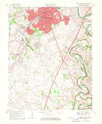
1968 Map of Bowling Green South
USGS Topo · Published 1970About this map
Western Kentucky University serves as a major focal point on this late-1960s survey, surrounded by the expanding urban footprint of Bowling Green. The landscape reflects a period of mid-century growth, where new residential developments like Crestmoor and Shawnee Estates push into former farmland south of the city center. This expansion follows established corridors like the Louisville and Nashville RR and the Nashville Road.
Find a feature on this map
75 named features on this map. Tap any name to fly to it.
Don’t see what you’re looking for? This feature index may not catch every label — zoom into the map to look around manually.
Map Details
Editions of this 1968 Bowling Green South Map
2 editions found
Other maps of this area

1914 · Little Muddy
USGS Topo · 1:62,500

1921 · Bowling Green
USGS Topo · 1:62,500

1922 · Brownsville
USGS Topo · 1:62,500

1923 · Bowling Green
USGS Topo · 1:62,500

1923 · Brownsville
USGS Topo · 1:62,500

1951 · Woodburn
USGS Topo · 1:24,000

1952 · Rockfield
USGS Topo · 1:24,000

1954 · Evansville
USGS Topo · 1:250,000

1954 · Bowling Green North
USGS Topo · 1:24,000

1954 · Drake
USGS Topo · 1:24,000
Featured Places
- Bowling Green, KY
- Briarwood Manor, Bowling Green
- Three Springs, KY
- Eastland Park, Bowling Green
- Greenwood, Bowling Green