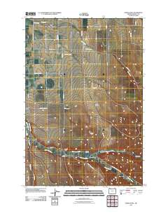
2011 Map of Bowlus Hill
USGS Topo · Published 2011About this map
Bowlus Hill stands as a prominent topographical feature in this northern Oregon landscape, where the high country transitions toward the river valleys near the State Line. The small settlement of Spofford remains a notable point of reference along Spofford Rd, serving a region defined by agricultural water management and rugged drainage patterns. The convergence of the Walla Walla River and the North Fork Walla Walla River dictates the local infrastructure, evidenced by landmarks such as the Joe West Bridge and Dorothy Bridge. Genealogists and local historians can locate the Bowlus Cemetery tucked between Powerline Rd and Hood Rd, while the presence of the Milton Ditch and Dorothy Ditch illustrates the long-standing reliance on irrigation systems to support the surrounding hollows, including Pumpkin Hollow and Cash Hollow.
Find a feature on this map
38 named features on this map. Tap any name to fly to it.
Don’t see what you’re looking for? This feature index may not catch every label — zoom into the map to look around manually.
Map Details
Editions of this 2011 Bowlus Hill Map
This is the sole edition of this map. No revisions or reprints were ever made.
Other maps of this area

1919 · Walla Walla
USGS Topo · 1:125,000

1921 · Walla Walla
USGS Topo · 1:125,000

1953 · Pendleton
USGS Topo · 1:250,000

1953 · Walla Walla
USGS Topo · 1:250,000

1956 · Pendleton
USGS Topo · 1:250,000

1958 · Walla Walla
USGS Topo · 1:250,000

1963 · Blalock Mountain
USGS Topo · 1:24,000

1963 · Peterson Ridge
USGS Topo · 1:24,000

1964 · Milton-Freewater
USGS Topo · 1:24,000

1964 · Athena
USGS Topo · 1:24,000