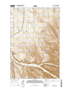
2014 Map of Bowlus Hill
USGS Topo · Published 2014About this map
Walla Walla Valley terrain dominates this landscape, where the Milton -Freewater area meets the rising slopes of the Blue Mountains. The drainage system is defined by the Walla Walla River and its North Fork, supplemented by agricultural irrigation features such as the Dorothy Ditch. Notable crossings including Joe West Bridge and Dorothy Bridge connect the valley floor to the more complex topography of Bowlus Canyon and Pumpkin Hollow.
Find a feature on this map
44 named features on this map. Tap any name to fly to it.
Don’t see what you’re looking for? This feature index may not catch every label — zoom into the map to look around manually.
Map Details
Editions of this 2014 Bowlus Hill Map
This is the sole edition of this map. No revisions or reprints were ever made.
Other maps of this area

1919 · Walla Walla
USGS Topo · 1:125,000

1921 · Walla Walla
USGS Topo · 1:125,000

1953 · Pendleton
USGS Topo · 1:250,000

1953 · Walla Walla
USGS Topo · 1:250,000

1956 · Pendleton
USGS Topo · 1:250,000

1958 · Walla Walla
USGS Topo · 1:250,000

1963 · Blalock Mountain
USGS Topo · 1:24,000

1963 · Peterson Ridge
USGS Topo · 1:24,000

1964 · Milton-Freewater
USGS Topo · 1:24,000

1964 · Athena
USGS Topo · 1:24,000