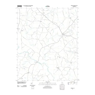
2011 Map of Bowman
USGS Topo · Published 2011About this map
Bowman serves as the primary hub for this portion of Elbert County, Georgia, where local roads radiate outward into a landscape defined by the drainage basins of the Broad River. The area is characterized by small rural settlements and crossroads like Vanna, Reeds, and Jeptha, many of which grew around early transportation routes and family farms. The map reveals the intricate network of local creek systems, including Mill Shoal Creek and Beaverdam Creek, which dictated the early placement of homesteads and mills.
Find a feature on this map
98 named features on this map. Tap any name to fly to it.
Don’t see what you’re looking for? This feature index may not catch every label — zoom into the map to look around manually.
Map Details
Editions of this 2011 Bowman Map
This is the sole edition of this map. No revisions or reprints were ever made.
Other maps of this area

1891 · Carnesville
USGS Topo · 1:125,000

1893 · Elberton
USGS Topo · 1:125,000

1954 · Greenville
USGS Topo · 1:250,000

1958 · Greenville
USGS Topo · 1:250,000

1958 · Danielsville
USGS Topo · 1:62,500

1958 · Elberton
USGS Topo · 1:62,500

1959 · Carnesville
USGS Topo · 1:24,000

1959 · Royston
USGS Topo · 1:24,000

1959 · Hartwell
USGS Topo · 1:24,000
1972 · Danielsville South
USGS Topo · 1:24,000