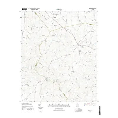
2017 Map of Bowman
USGS Topo · Published 2017About this map
The Broad River flows through this northeastern Georgia landscape, marking the natural boundary between Madison and Elbert counties. The town of Bowman serves as a central hub, where residential streets meet a network of rural roads that stretch toward outlying communities like Vanna and Harrison. Local history and genealogy are anchored by several community landmarks, including Fellowship Cem, Pleasant Grove Cem, and Rehoboth Cem, which trace the settlement patterns of these agricultural lands.
Find a feature on this map
150 named features on this map. Tap any name to fly to it.
Don’t see what you’re looking for? This feature index may not catch every label — zoom into the map to look around manually.
Map Details
Editions of this 2017 Bowman Map
This is the sole edition of this map. No revisions or reprints were ever made.
Other maps of this area

1891 · Carnesville
USGS Topo · 1:125,000

1893 · Elberton
USGS Topo · 1:125,000

1954 · Greenville
USGS Topo · 1:250,000

1958 · Greenville
USGS Topo · 1:250,000

1958 · Danielsville
USGS Topo · 1:62,500

1958 · Elberton
USGS Topo · 1:62,500

1959 · Carnesville
USGS Topo · 1:24,000

1959 · Royston
USGS Topo · 1:24,000

1959 · Hartwell
USGS Topo · 1:24,000
1972 · Danielsville South
USGS Topo · 1:24,000