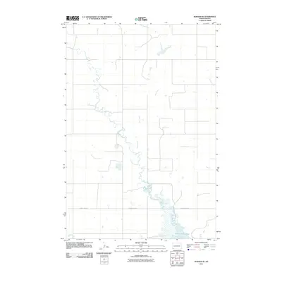
2011 Map of Bowman SE
USGS Topo · Published 2011About this map
Bowman-Haley Lake dominates the southern reaches of this landscape, where the confluence of several key drainages defines the local hydrology. The map illustrates a network of prairie waterways, most notably Stage Creek and Spring Creek, which wind through the terrain to feed the larger reservoir. These natural corridors are supplemented by Cold Turkey Creek and Alkali Creek to the west, while Lightning Creek traces the eastern boundary. This area of Bowman County is characterized by a sparse, organized road network, with County Hwy-0818 serving as a primary east-west artery across the central plains. The lack of concentrated town sites emphasizes the agricultural and open-range character of the region during this period.
Find a feature on this map
7 named features on this map. Tap any name to fly to it.
Don’t see what you’re looking for? This feature index may not catch every label — zoom into the map to look around manually.
Map Details
Editions of this 2011 Bowman SE Map
This is the sole edition of this map. No revisions or reprints were ever made.
Other maps of this area

1935 · Reva
USGS Topo · 1:125,000

1953 · Dickinson
USGS Topo · 1:250,000

1954 · Lemmon
USGS Topo · 1:250,000

1957 · Dickinson
USGS Topo · 1:250,000

1957 · Lemmon
USGS Topo · 1:250,000

1968 · Bowman SW
USGS Topo · 1:24,000

1968 · Bowman
USGS Topo · 1:24,000

1968 · Eagles Nest Butte
USGS Topo · 1:24,000

1968 · Bowman-Haley Dam
USGS Topo · 1:24,000

1968 · Tepee Buttes
USGS Topo · 1:24,000