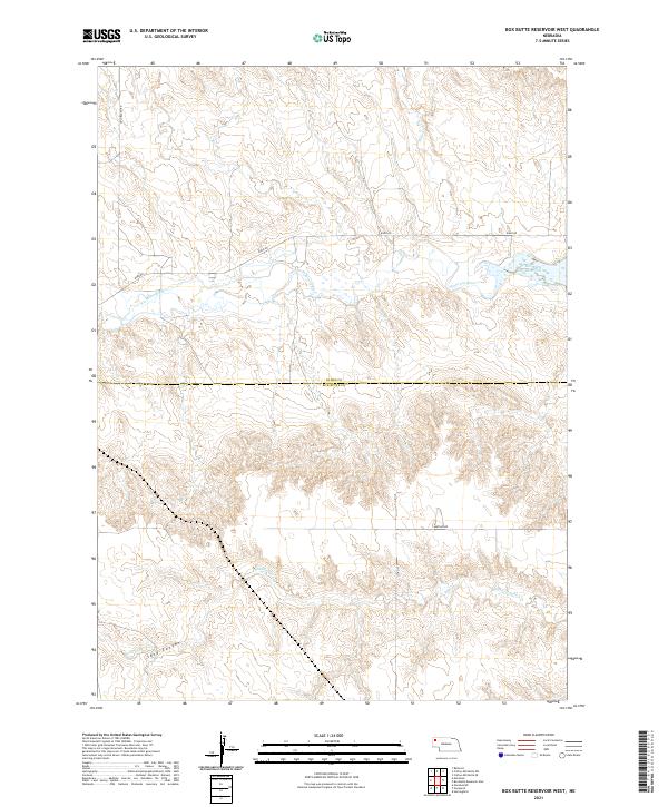
2021 Map of Box Butte Reservoir West
USGS Topo · Published 2021About this map
The Niobrara River flows through the northern reaches of this High Plains landscape, feeding the western edge of Box Butte Reservoir. This section of the river valley is defined by its seasonal drainage patterns and the transition between agricultural use and the natural breaks of the Sand Canyon region. In the southern half of the quadrangle, the terrain becomes more complex as Sand Canyon Cr carves through the earth, creating a series of draws and ridges that define the local topography.
Find a feature on this map
14 named features on this map. Tap any name to fly to it.
Don’t see what you’re looking for? This feature index may not catch every label — zoom into the map to look around manually.
Map Details
Editions of this 2021 Box Butte Reservoir West Map
This is the sole edition of this map. No revisions or reprints were ever made.
Other maps of this area

1946 · Nonpareil
USGS Topo · 1:24,000

1946 · Box Butte Reservoir West
USGS Topo · 1:24,000

1948 · Box Butte Reservoir West
USGS Topo · 1:24,000

1948 · Hemingford
USGS Topo · 1:24,000

1948 · Nonpareil
USGS Topo · 1:24,000

1948 · Box Butte Reservoir East
USGS Topo · 1:24,000

1951 · Marsland
USGS Topo · 1:62,500

1955 · Alliance
USGS Topo · 1:250,000

1957 · Alliance
USGS Topo · 1:250,000

1958 · Alliance
USGS Topo · 1:250,000