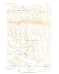
1953 Map of Box Elder
USGS Topo · Published 1955About this map
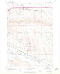
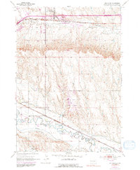
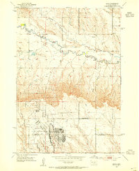
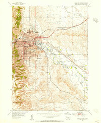
Ellsworth Air Force Base dominates the northern landscape of this Pennington County region, situated just north of the Chicago and North Western rail line. The mid-century development of the area is further evidenced by the sprawling Rapid City Municipal Airport and the specialized U. S. Government Railroad spur. Below these infrastructure hubs, the terrain is defined by the winding paths of Boxelder Creek and Rapid Creek, supported by an intricate irrigation system including the Iowa Ditch, Hawthorne Ditch, and Murphy Ditch. Small rural centers such as the Rapid Valley Community Hall and local institutions like White Eagle Sch and Lone Tree Sch offer clear reference points for those researching family history or the early post-war layout of the Black Hills foothills before modern suburban expansion.
Find a feature on this map
21 named features on this map. Tap any name to fly to it.
Don’t see what you’re looking for? This feature index may not catch every label — zoom into the map to look around manually.
Map Details
Editions of this 1953 Box Elder Map
4 editions found
Other maps of this area

1893 · Rapid
USGS Topo · 1:125,000

1894 · Hermosa
USGS Topo · 1:125,000

1898 · Rapid
USGS Topo · 1:125,000

1901 · Hermosa
USGS Topo · 1:125,000

1903 · Rapid
USGS Topo · 1:125,000
1953 · Bend
USGS Topo · 1:24,000
1953 · Boxelder
USGS Topo · 1:24,000
1953 · Hermosa NW
USGS Topo · 1:24,000
1953 · Rapid City East
USGS Topo · 1:24,000
1953 · Rapid City NW
USGS Topo · 1:24,000