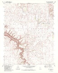
1979 Map of Box K Ranch
USGS Topo · Published 1985About this map
Box K Ranch sits at the heart of this high-plateau landscape, surrounded by an essential network of water management features like Box K Tank and Box K Dam. The terrain is dramatically bisected by the winding descent of Cataract Canyon, which carves a deep path through the Coconino county countryside. This 1970s survey illustrates the intersection of large-scale cattle ranching operations and indigenous land boundaries, specifically where the ranching lands meet the eastern edge of the Havasupai Indian Reservation. The reliance on local water sources is evident through the naming of various catchments such as Bills Tank and Balboa Tank, which sustained livestock in an area where Coconino Wash provides a primary natural drainage route.
Find a feature on this map
12 named features on this map. Tap any name to fly to it.
Don’t see what you’re looking for? This feature index may not catch every label — zoom into the map to look around manually.
Map Details
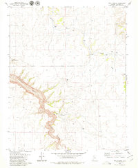
Editions of this 1979 Box K Ranch Map
2 editions found
Other maps of this area

1886 · Chino
USGS Topo · 1:250,000

1886 · Kaibab
USGS Topo · 1:250,000

1891 · Chino
USGS Topo · 1:250,000

1948 · Williams
USGS Topo · 1:250,000

1953 · Grand Canyon
USGS Topo · 1:250,000

1954 · Williams
USGS Topo · 1:250,000

1956 · Williams
USGS Topo · 1:250,000

1957 · Grand Canyon
USGS Topo · 1:250,000

1958 · Grand Canyon
USGS Topo · 1:250,000

1960 · Williams
USGS Topo · 1:250,000