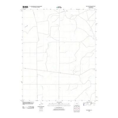
2010 Map of Box Ranch
USGS Topo · Published 2010About this map
Box Ranch anchors the northern reaches of this Las Animas County landscape, where the high plains terrain is defined by the drainage systems of Bachicha Creek and Chacuaco Creek. In this corner of southern Colorado, the geographic character is shaped by the presence of Piñon Ridge in the northwest, a prominent landform that overlooks a network of rural transit routes. The infrastructure is primarily composed of unpaved access ways, notably County Rd 143 and County Rd 147, which trace the contours of the watershed. This area illustrates the late 20th and early 21st-century cattle ranching patterns of the region, where settlement is sparse and dictated by water sources and the natural shelter provided by the ridge systems. The survey demonstrates how modern county road systems like County Rd 34.7 have maintained the historical connectivity between isolated ranching outposts and the larger Colorado frontier.
Find a feature on this map
7 named features on this map. Tap any name to fly to it.
Don’t see what you’re looking for? This feature index may not catch every label — zoom into the map to look around manually.
Map Details
Editions of this 2010 Box Ranch Map
This is the sole edition of this map. No revisions or reprints were ever made.
Other maps of this area

1891 · Mesa De Maya
USGS Topo · 1:125,000

1893 · Mesa de Maya
USGS Topo · 1:125,000

1955 · La Junta
USGS Topo · 1:250,000

1958 · La Junta
USGS Topo · 1:250,000

1968 · La Junta
USGS Topo · 1:250,000
1972 · Branson SE
USGS Topo · 1:24,000

1972 · Miners Peak
USGS Topo · 1:24,000

1972 · Doss Canyon South
USGS Topo · 1:24,000
1972 · Branson
USGS Topo · 1:24,000
1972 · Painted Canyon
USGS Topo · 1:24,000