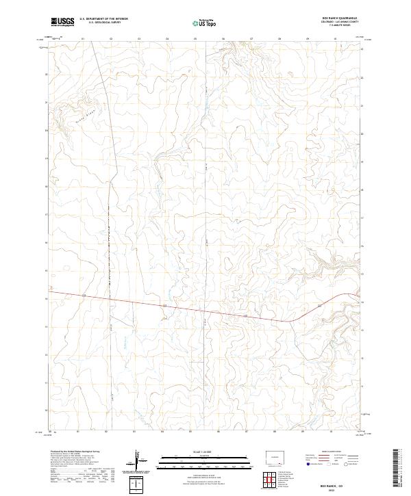
2022 Map of Box Ranch
USGS Topo · Published 2022About this map
Piñon Ridge rises across the northwestern corner of this territory in Las Animas County, shaping the drainage patterns for the intermittent waterways below. The landscape is defined by the winding course of Bachicha Cr, which cuts a north-south path through the center of the survey area, joined in the southeast by the headwaters of Chacuaco Cr. This part of the High Plains transition illustrates a traditional ranching layout, where movement is dictated by the rugged topography and a network of secondary routes including Co Rd 147 and Co Rd 143. The map preserves the 2022 survey of section lines and townships, revealing how property boundaries and local transit remain tied to the natural elevation of the Colorado plateau.
Find a feature on this map
10 named features on this map. Tap any name to fly to it.
Don’t see what you’re looking for? This feature index may not catch every label — zoom into the map to look around manually.
Map Details
Editions of this 2022 Box Ranch Map
This is the sole edition of this map. No revisions or reprints were ever made.
Other maps of this area

1891 · Mesa De Maya
USGS Topo · 1:125,000

1893 · Mesa de Maya
USGS Topo · 1:125,000

1955 · La Junta
USGS Topo · 1:250,000

1958 · La Junta
USGS Topo · 1:250,000

1968 · La Junta
USGS Topo · 1:250,000
1972 · Branson SE
USGS Topo · 1:24,000

1972 · Miners Peak
USGS Topo · 1:24,000

1972 · Doss Canyon South
USGS Topo · 1:24,000
1972 · Branson
USGS Topo · 1:24,000
1972 · Painted Canyon
USGS Topo · 1:24,000