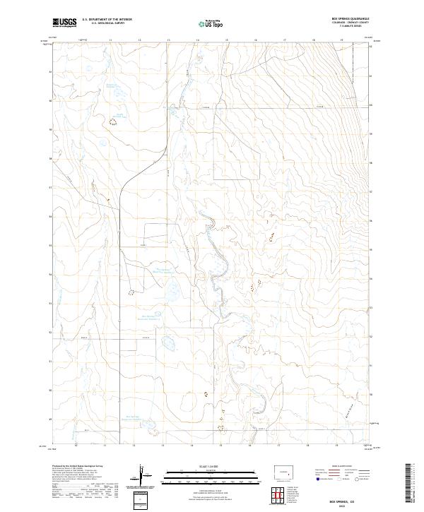
2022 Map of Box Springs
USGS Topo · Published 2022About this map
Box Springs and its surrounding plains in Crowley County reveal a landscape defined by the careful management of water. This arid terrain is marked by a series of numbered impoundments, including Box Springs Reservoir Number 1, Box Springs Reservoir Number 3, and Box Springs Reservoir Number 5, which are essential for sustaining agricultural or livestock operations in this portion of the Arkansas River Valley drainage.
Find a feature on this map
24 named features on this map. Tap any name to fly to it.
Don’t see what you’re looking for? This feature index may not catch every label — zoom into the map to look around manually.
Map Details
Editions of this 2022 Box Springs Map
This is the sole edition of this map. No revisions or reprints were ever made.
Other maps of this area

1889 · Sanborn
USGS Topo · 1:125,000

1891 · Sanborn
USGS Topo · 1:125,000

1891 · Catlin
USGS Topo · 1:125,000

1893 · Sanborn
USGS Topo · 1:125,000

1893 · Catlin
USGS Topo · 1:125,000

1954 · Lamar
USGS Topo · 1:250,000

1958 · Lamar
USGS Topo · 1:250,000

1977 · Walker Point
USGS Topo · 1:24,000
1977 · The Pinnacles
USGS Topo · 1:24,000
1977 · Box Springs
USGS Topo · 1:24,000