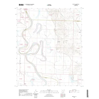
2020 Map of Boyd Hill
USGS Topo · Published 2020About this map
The Red River meanders across this landscape, defining the boundaries of Miller, Hempstead, and Lafayette Counties with its deep oxbows and shifting path. This riverine environment is shaped by water, featuring numerous wetlands and secondary channels such as Field Bayou, Kitchen Bayou, and Moccasin Bayou. Along the higher ground to the east, the settlement of Boyd Hill sits above the floodplain, accompanied by the Boyd Hill Cem. The western edge of the quadrangle is marked by Beck, situated near the historic route of Dooley Ferry Rd. To the south, Mayton appears near the confluence of local drainages, while Clear Lake and Grassy Lake occupy the broad bottomlands, illustrating the complex hydrology of the Red River valley.
Find a feature on this map
46 named features on this map. Tap any name to fly to it.
Don’t see what you’re looking for? This feature index may not catch every label — zoom into the map to look around manually.
Map Details
Editions of this 2020 Boyd Hill Map
This is the sole edition of this map. No revisions or reprints were ever made.
Other maps of this area

1951 · Patmos
USGS Topo · 1:24,000

1951 · Fulton
USGS Topo · 1:24,000

1951 · Spring Hill
USGS Topo · 1:24,000

1952 · Garland
USGS Topo · 1:24,000

1952 · Fouke SE
USGS Topo · 1:24,000

1952 · Old Town
USGS Topo · 1:24,000

1952 · Lewisville
USGS Topo · 1:24,000

1952 · Fouke NE
USGS Topo · 1:24,000

1952 · Boyd Hill
USGS Topo · 1:24,000

1953 · El Dorado
USGS Topo · 1:250,000