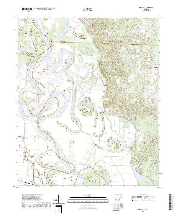
2024 Map of Boyd Hill
USGS Topo · Published 2024About this map
The winding Red River defines this corner of southwest Arkansas, carving complex oxbows and leave-behind lakes across the county lines of Lafayette, Miller, and Hempstead. The landscape is a study in fluvial morphology, where remnants of the river's former path persist as Clear Lake, Red Lake, and the elongated Grassy Lake. These low-lying wetlands contrast sharply with the elevated terrain of Boyd Hill, which provides a namesake anchor for the local community and the nearby Boyd Hill Cem.
Find a feature on this map
41 named features on this map. Tap any name to fly to it.
Don’t see what you’re looking for? This feature index may not catch every label — zoom into the map to look around manually.
Map Details
Editions of this 2024 Boyd Hill Map
This is the sole edition of this map. No revisions or reprints were ever made.
Other maps of this area

1951 · Patmos
USGS Topo · 1:24,000

1951 · Fulton
USGS Topo · 1:24,000

1951 · Spring Hill
USGS Topo · 1:24,000

1952 · Garland
USGS Topo · 1:24,000

1952 · Fouke SE
USGS Topo · 1:24,000

1952 · Old Town
USGS Topo · 1:24,000

1952 · Lewisville
USGS Topo · 1:24,000

1952 · Fouke NE
USGS Topo · 1:24,000

1952 · Boyd Hill
USGS Topo · 1:24,000

1953 · El Dorado
USGS Topo · 1:250,000