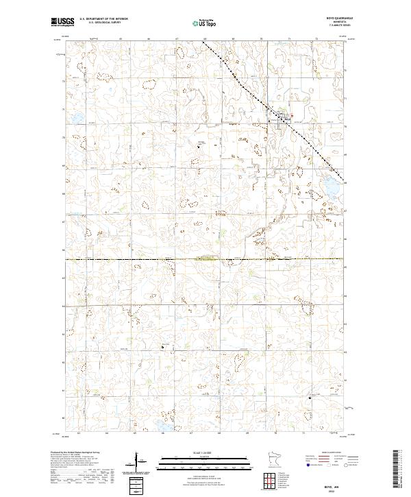
2022 Map of Boyd
USGS Topo · Published 2022About this map
The small town of Boyd serves as the focal point of this agricultural landscape in western Minnesota. This survey highlights the rural grid system that defines the region, where gravel roads like Co HWY 29 and Co HWY 2 connect isolated farmsteads across the prairie. The geography is characterized by the divide between Lac Qui Parle Co and Yellow Medicine Co, with the northern section dominated by the waters of Tenmile Lake and the meandering path of Tenmile Cr. For those researching local family history, several prominent burial grounds are preserved across the landscape, including Trinity Cem on the edge of town, and more remote sites such as Ten Mile Lake Cem, Zion Cem, and Fridhem Cem. The inclusion of the town's Po and the meticulous numbering of township sections reveal the enduring structure of this prairie community.
Find a feature on this map
39 named features on this map. Tap any name to fly to it.
Don’t see what you’re looking for? This feature index may not catch every label — zoom into the map to look around manually.
Map Details
Editions of this 2022 Boyd Map
This is the sole edition of this map. No revisions or reprints were ever made.
Other maps of this area

1953 · Watertown
USGS Topo · 1:250,000

1953 · New Ulm
USGS Topo · 1:250,000

1957 · New Ulm
USGS Topo · 1:250,000

1958 · New Ulm
USGS Topo · 1:250,000

1958 · Watertown
USGS Topo · 1:250,000

1965 · Clarkfield
USGS Topo · 1:24,000
1965 · Clarkfield NE
USGS Topo · 1:24,000
1965 · Tenmile Lake
USGS Topo · 1:24,000

1965 · Boyd
USGS Topo · 1:24,000

1967 · New Ulm
USGS Topo · 1:250,000