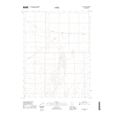
2020 Map of Boyd Station
USGS Topo · Published 2020About this map
Boyd Station sits at the heart of this Juab County landscape, a site deeply tied to the historic transit corridors of the American West. The map highlights the enduring path of Pony Express Rd, which traverses the terrain from east to west, intersecting with Granite Ranch Rd near the station. This geography illustrates a reliance on established desert routes and intermittent water sources, such as the Roadside Reservoir. The southern reaches are defined by the Weiss Hwy, while the surrounding topography consists of broad basins and isolated ridges. This survey provides a precise view of modern access points and land management boundaries in a region where historical mail routes remain the primary physical landmarks.
Find a feature on this map
5 named features on this map. Tap any name to fly to it.
Don’t see what you’re looking for? This feature index may not catch every label — zoom into the map to look around manually.
Map Details
Editions of this 2020 Boyd Station Map
This is the sole edition of this map. No revisions or reprints were ever made.
Other maps of this area

1908 · Fish Springs
USGS Topo · 1:250,000

1910 · Fish Springs
USGS Topo · 1:250,000

1953 · Delta
USGS Topo · 1:250,000

1958 · Delta
USGS Topo · 1:250,000

1960 · Granite Mountain
USGS Topo · 1:62,500

1962 · Delta
USGS Topo · 1:250,000

1967 · Sand Pass NW
USGS Topo · 1:24,000

1967 · Fish Springs NW
USGS Topo · 1:24,000
1967 · Fish Springs SW
USGS Topo · 1:24,000

1972 · Mud Lake Reservoir
USGS Topo · 1:24,000