
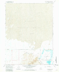
1967 Map of Fish Springs NW
USGS Topo · Published 1971About this map
Pony Express Road traverses the northern edge of the Fish Springs Range, following a path of vital water sources through the desert. This 1967 survey highlights the environmental transition from the arid expanse of Mud Flat and the Dugway Proving Ground to the lush wetlands of the Fish Springs National Wildlife Refuge. The map identifies several key hydrologic features including Wilson Health Springs, North Springs, and Deadman Spring, which historically supported travelers and wildlife in an otherwise harsh basin. Along the eastern edge, managed water bodies like Pintail Pool and Harrison Pool contrast with the open Flat to the south. The presence of a Gravel Pit and the established Military Reservation Boundary reflect the mid-century intersection of conservation, defense, and infrastructure in Tooele County.
Find a feature on this map
20 named features on this map. Tap any name to fly to it.
Don’t see what you’re looking for? This feature index may not catch every label — zoom into the map to look around manually.
Map Details
Editions of this 1967 Fish Springs NW Map
2 editions found
Other maps of this area

1908 · Fish Springs
USGS Topo · 1:250,000

1910 · Fish Springs
USGS Topo · 1:250,000

1953 · Tooele
USGS Topo · 1:250,000

1953 · Delta
USGS Topo · 1:250,000

1954 · Granite Peak SE
USGS Topo · 1:24,000

1955 · Tooele
USGS Topo · 1:250,000

1958 · Delta
USGS Topo · 1:250,000

1962 · Delta
USGS Topo · 1:250,000

1967 · Fish Springs SE
USGS Topo · 1:24,000
1967 · Fish Springs SW
USGS Topo · 1:24,000