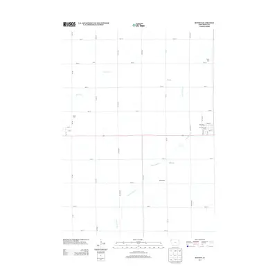
2013 Map of Boyden
USGS Topo · Published 2013About this map
The W Br Floyd River and Burr Oak Cr drain this agricultural landscape in Sioux County, Iowa, where the township grid dictates the placement of farmsteads and rural roads. The town of Boyden serves as the primary settlement on this survey, featuring a distinct street grid near the intersection of Main St and Taft St. Leisure and commerce are represented by the Otter Valley Golf Course and several named agricultural operations including the Boogerd Dairy and Wielenga Dairy. The map also captures smaller named locales such as Athol and family-owned properties like Spruce Lawn Farm and M W Farm. This detailed topographic view illustrates the modern intersection of industry and rural life in northwest Iowa, recording a moment in time before further consolidation of regional agriculture.
Find a feature on this map
32 named features on this map. Tap any name to fly to it.
Don’t see what you’re looking for? This feature index may not catch every label — zoom into the map to look around manually.
Map Details
Editions of this 2013 Boyden Map
This is the sole edition of this map. No revisions or reprints were ever made.
Other maps of this area
1954 · Fairmont
USGS Topo · 1:250,000
1955 · Sioux Falls
USGS Topo · 1:250,000
1958 · Sioux Falls
USGS Topo · 1:250,000
1958 · Fairmont
USGS Topo · 1:250,000
1964 · Hospers
USGS Topo · 1:24,000
1964 · Matlock
USGS Topo · 1:24,000
1964 · Orange City
USGS Topo · 1:24,000
1964 · Boyden
USGS Topo · 1:24,000
1964 · Sioux Center
USGS Topo · 1:24,000
1964 · Hull
USGS Topo · 1:24,000