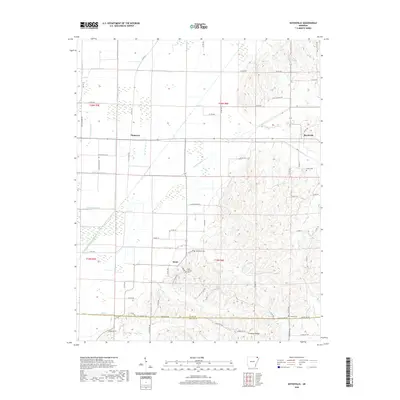
2020 Map of Boydsville
USGS Topo · Published 2020About this map
Crowleys Ridge dominates the eastern half of this landscape, its elevated contours providing a sharp contrast to the low-lying agricultural drainage systems to the west. This geological feature served as a natural anchor for early settlements and cemeteries, including the community of Boydsville and the Rock Springs Cem. The map illustrates a complex hydraulic network designed to manage the wetlands of the Mississippi Embayment, featuring Cache River Ditch Number 1 and numerous numbered ditches such as Ditch Number 25 through Ditch Number 28. These man-made channels intersect with natural waterways like Johnson Cr and Mill Cr. Along the border of Clay Co and Greene Co, small rural hubs like Knob and Tipperary are situated near several local burial grounds, including Bethlehem Cem and Purcel Cem, offering valuable points of interest for those researching the genealogy of these Northeast Arkansas communities.
Find a feature on this map
74 named features on this map. Tap any name to fly to it.
Don’t see what you’re looking for? This feature index may not catch every label — zoom into the map to look around manually.
Map Details
Editions of this 2020 Boydsville Map
This is the sole edition of this map. No revisions or reprints were ever made.
Other maps of this area

1935 · Rector
USGS Topo · 1:62,500

1935 · Knobel
USGS Topo · 1:62,500

1940 · Gainesville
USGS Topo · 1:62,500

1940 · Marmaduke
USGS Topo · 1:62,500

1941 · Knobel
USGS Topo · 1:62,500

1957 · Poplar Bluff
USGS Topo · 1:250,000

1958 · Marmaduke
USGS Topo · 1:62,500

1958 · Gainesville
USGS Topo · 1:62,500

1958 · Rector
USGS Topo · 1:62,500

1959 · Poplar Bluff
USGS Topo · 1:250,000