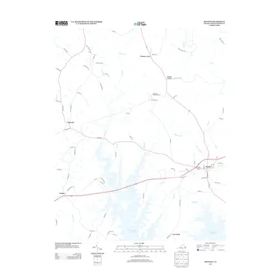
2013 Map of Boydton
USGS Topo · Published 2013About this map
The town of Boydton serves as the focal point of this Southside Virginia landscape, which is defined by its relationship with the vast waters of the John H. Kerr Reservoir. The map illustrates a rural network of small communities and crossroads such as Skipwith, Finchley, and Dodson Corner, linked by a web of local routes like Skipwith Rd and Puryears Store Rd. The terrain is deeply etched by a high density of drainage features, including Butcher Cr, Jolly Hollow Br, and Tates Br, which feed into the reservoir's complex shoreline. Unique landmarks like Murdock's Holly Bu Airport and the settlement at Greenfield provide specific points of interest for those tracing the modern geography of Mecklenburg County. The infrastructure is characterized by the transition from upland creek valleys to the artificial shoreline of the reservoir, illustrating how the regional water management projects of the mid-20th century transformed these old Piedmont drainage basins.
Find a feature on this map
76 named features on this map. Tap any name to fly to it.
Don’t see what you’re looking for? This feature index may not catch every label — zoom into the map to look around manually.
Map Details
Editions of this 2013 Boydton Map
This is the sole edition of this map. No revisions or reprints were ever made.
Other maps of this area

1941 · Clarksville
USGS Topo · 1:48,000

1943 · Clarksville
USGS Topo · 1:62,500

1953 · Greensboro
USGS Topo · 1:250,000

1954 · Greensboro
USGS Topo · 1:250,000

1954 · Clover
USGS Topo · 1:62,500

1955 · Chase City
USGS Topo · 1:62,500

1955 · Boydton
USGS Topo · 1:62,500

1957 · Clarksville
USGS Topo · 1:62,500

1962 · Greensboro
USGS Topo · 1:250,000

1966 · Greensboro
USGS Topo · 1:250,000