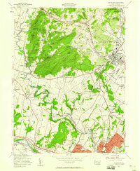
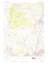
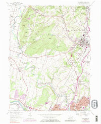
1957 Map of Boyertown
USGS Topo · Published 1958About this map
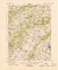
Manatawny Creek winds through the heart of this Pennsylvania landscape, connecting old industrial and agricultural hubs during a period of mid-century growth. The map captures the distinct character of southeastern Berks County, where steep wooded ridges like Fancy Hill and Long Hill tower over narrow valleys filled with iron-heritage settlements. In the village of Pine Forge, the presence of the Pine Forge Institute speaks to the area's educational development, while to the north, the isolated cluster of Woodchoppertown reflects the local timber and charcoal roots. The southeastern corner is dominated by the northern reaches of Pottstown, showing the dense street grid and industrial footprint near the Schuylkill River. From the Boyertown Reservoir to the Pottstown Municipal Airport, the map documents a transition from traditional rural townships into a more modern suburban and industrial corridor.
Find a feature on this map
96 named features on this map. Tap any name to fly to it.
Don’t see what you’re looking for? This feature index may not catch every label — zoom into the map to look around manually.
Map Details
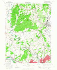
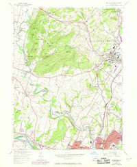
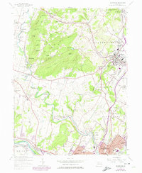
Editions of this 1957 Boyertown Map
6 editions found
Other maps of this area

1894 · Reading
USGS Topo · 1:62,500

1902 · Boyertown
USGS Topo · 1:62,500

1905 · Honey Brook
USGS Topo · 1:62,500

1906 · Phoenixville
USGS Topo · 1:62,500

1907 · Honeybrook
USGS Topo · 1:62,500
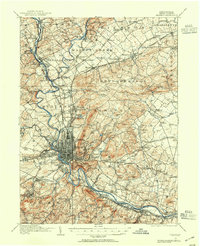
1913 · Reading
USGS Topo · 1:62,500
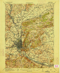
1915 · Reading
USGS Topo · 1:62,500

1941 · Honeybrook
USGS Topo · 1:62,500

1943 · Manatawny
USGS Topo · 1:31,680
1943 · East Greenville
USGS Topo · 1:31,680
Featured Places
- Pottstown, PA
- Colebrookdale, Douglass Township
- Boyertown, PA
- West Pottsgrove, PA
- Amity Gardens, Amity Township