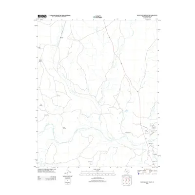
2012 Map of Boys Ranch West
USGS Topo · Published 2012About this map
The Canadian River cuts a wide, braided path across this Panhandle landscape, anchoring a region defined by remote ranching outposts and high-plains water sources. Near the river's southern bend, the settlement of Boys Ranch and the site of Tascosa serve as the primary human hubs, connected by State Loop 233 and FM-1061. Genealogists and local historians will find significant value in the documentation of Boot Hill Cem and Muncy Cem, which speak to the area's frontier heritage. The map details an extensive network of specialized cattle-country landmarks, including Hollicott Camp and a series of named water-pumping stations like the Shipping Pasture Windmill, Trujillo Windmill, and Turner Windmill. These features, alongside the drainage basins of W Cheyenne Creek and Rica Creek, illustrate the persistent infrastructure required for ranching in Oldham County.
Find a feature on this map
28 named features on this map. Tap any name to fly to it.
Don’t see what you’re looking for? This feature index may not catch every label — zoom into the map to look around manually.
Map Details
Editions of this 2012 Boys Ranch West Map
This is the sole edition of this map. No revisions or reprints were ever made.
Other maps of this area

1934 · Ady
USGS Topo · 1:62,500

1936 · Ady
USGS Topo · 1:62,500

1954 · Tucumcari
USGS Topo · 1:250,000

1958 · Tucumcari
USGS Topo · 1:250,000

1966 · Halfway Creek
USGS Topo · 1:24,000

1966 · Ady
USGS Topo · 1:24,000

1966 · Torrea Peak
USGS Topo · 1:24,000

1971 · Bivins Channing Ranch
USGS Topo · 1:24,000

1971 · Channing NW
USGS Topo · 1:24,000

1971 · Boys Ranch West
USGS Topo · 1:24,000