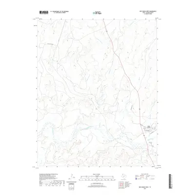
2019 Map of Boys Ranch West
USGS Topo · Published 2019About this map
Boys Ranch sits at the confluence of several Panhandle waterways, serving as the primary cultural anchor for this portion of the Texas landscape. The settlement is positioned where Tascosa Cr meets the braided channels of the Canadian River, an area marked by deep ranching history. Local landmarks like Boot Hill Cem and Cal Farley's Boys Ranch Cem reflect the unique legacy of the site, which was once the location of the historic town of Tascosa. Beyond the settlement, the terrain is defined by a complex drainage network including Rica Cr, Alamosa Cr, and the various branches of Cheyenne Creek. Significant ranching corridors such as Quien Sabe Ranch Rd and Bivins Ranch Rd provide access through the rolling breaks and river bottoms, connecting the outlying Muncy Cem and various rural holdings to the main community center.
Find a feature on this map
21 named features on this map. Tap any name to fly to it.
Don’t see what you’re looking for? This feature index may not catch every label — zoom into the map to look around manually.
Map Details
Editions of this 2019 Boys Ranch West Map
This is the sole edition of this map. No revisions or reprints were ever made.
Other maps of this area

1934 · Ady
USGS Topo · 1:62,500

1936 · Ady
USGS Topo · 1:62,500

1954 · Tucumcari
USGS Topo · 1:250,000

1958 · Tucumcari
USGS Topo · 1:250,000

1966 · Halfway Creek
USGS Topo · 1:24,000

1966 · Ady
USGS Topo · 1:24,000

1966 · Torrea Peak
USGS Topo · 1:24,000

1971 · Bivins Channing Ranch
USGS Topo · 1:24,000

1971 · Channing NW
USGS Topo · 1:24,000

1971 · Boys Ranch West
USGS Topo · 1:24,000