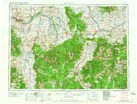
1965 Map of Bozeman
USGS Topo · Published 1965About this map
Bozeman and Livingston serve as the primary hubs in this mid-century portrait of southwestern Montana, where the headwaters of the Missouri River form at the confluence of the Madison River, Gallatin River, and Jefferson River. The map highlights the region's academic and civic infrastructure, from Montana State College to the Bozeman Cem. Heavy industrial and transport lines define the valley floors, with the Northern Pacific RR and the Chicago Milwaukee St Paul and Pacific RR threading through mountain passes to reach timber and mineral resources.
Find a feature on this map
87 named features on this map. Tap any name to fly to it.
Don’t see what you’re looking for? This feature index may not catch every label — zoom into the map to look around manually.
Map Details
Editions of this 1965 Bozeman Map
This is the sole edition of this map. No revisions or reprints were ever made.
Other maps of this area

1885 · Gallatin
USGS Topo · 1:125,000

1885 · Gallatin
USGS Topo · 1:125,000

1886 · Fort Logan
USGS Topo · 1:250,000

1886 · Canyon
USGS Topo · 1:125,000

1886 · Little Belt Mts.
USGS Topo · 1:250,000

1888 · Three Forks
USGS Topo · 1:250,000

1889 · Big Snowy Mountain
USGS Topo · 1:250,000

1889 · Helena
USGS Topo · 1:250,000

1891 · Livingston
USGS Topo · 1:250,000

1891 · Big Timber
USGS Topo · 1:125,000