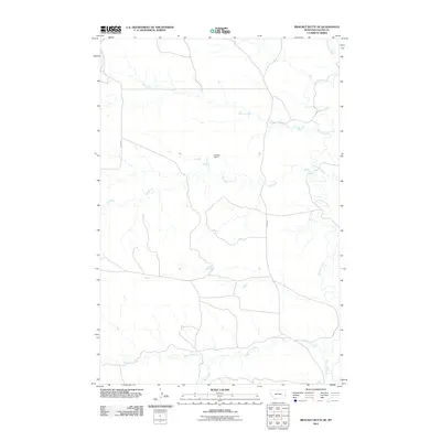
2011 Map of Bracket Butte SE
USGS Topo · Published 2011About this map
O'Fallon Creek and its network of tributaries define the topography of this corner of Fallon County. In this arid reach of eastern Montana, the collection of water is a primary concern, evidenced by the presence of Savage Dam and the meandering paths of Spring Creek, Hay Creek, and Miles City Creek. The landscape is etched by these drainage patterns, which dictate the placement of local infrastructure like Ismay Rd and Road 328. This map captures the area as a pastoral landscape of wide drainages and sparse road networks, typical of the high plains before further modern development. Researchers can trace the precise contours of the creek beds and the strategic positioning of small-scale water management features that have historically supported ranching and agriculture in this open range environment.
Find a feature on this map
8 named features on this map. Tap any name to fly to it.
Don’t see what you’re looking for? This feature index may not catch every label — zoom into the map to look around manually.
Map Details
Editions of this 2011 Bracket Butte SE Map
This is the sole edition of this map. No revisions or reprints were ever made.
Other maps of this area

1953 · Miles City
USGS Topo · 1:250,000

1957 · Miles City
USGS Topo · 1:250,000

1958 · Miles City
USGS Topo · 1:250,000

1981 · Baker
USGS Topo · 1:100,000

1981 · Harmon Butte
USGS Topo · 1:24,000
1981 · Bracket Butte
USGS Topo · 1:24,000

1981 · Nelson Butte
USGS Topo · 1:24,000

1981 · Bracket Butte SE
USGS Topo · 1:24,000
1981 · Hooky Dam
USGS Topo · 1:24,000
1981 · Ismay South
USGS Topo · 1:24,000