Old Maps of Fallon County, Montana
Explore 285 old maps of Fallon County, spanning from 1953 to today. These high-resolution historic maps reveal how streets, neighborhoods, landmarks, and natural features evolved over time — perfect for genealogy, metal detecting, research, and local history exploration.
What you can do with these maps:
- See how Fallon County changed over time: Compare historical maps to modern-day views to trace roads, homesites, rail lines & more.
- View detailed metadata: Each map includes creators, publishers, year, scale, and archive source.
- Overlay maps with satellite & LiDAR: Visualize the past alongside modern tools to explore terrain & human change.
- Trusted historical sources: Maps sourced from the USGS, Library of Congress, and other archives.
- Access maps your way: View online, download high-res files, or order prints for personal or research use.
Start exploring old maps of Fallon County to uncover forgotten places, hidden landmarks, and the deep history beneath your feet.
Fallon County, MT maps
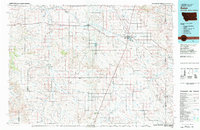
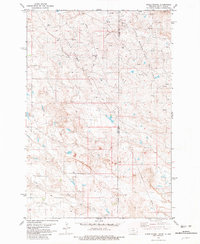
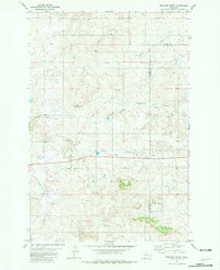
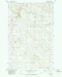
(285)- 1953 Map of Miles City, 1966 Print
 1953 Miles City1966 Print · USGSEastern Montana and the North Dakota borderlands come alive in this mid-century survey of the Yellowstone River valley. Genealogists and historians can trace the rural network of the era through sites like Fertile Prairie School, St Johns Church, and the rail lines serving Ismay and Plevna.4 unique versions available
 - 1954 Map of Ekalaka, 1966 Print
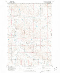
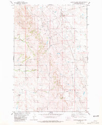
 1954 Ekalaka1966 Print · USGSSoutheastern Montana and its borderlands with the Dakotas and Wyoming appear here in the mid-fifties, showing a remote ranching landscape. Genealogists can trace family roots through numerous rural landmarks like the Sherwin School, St Marys Ch, and Powderville.3 unique versions available
 - 1956 Map of Ekalaka
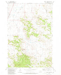
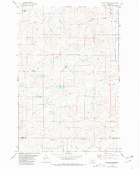
 1956 Ekalaka1956 Print · USGSSoutheast Montana and the Wyoming borderlands are shown here in the mid-fifties, capturing a landscape of remote ranching outposts and isolated country schools. Genealogists can trace family roots through landmarks like Boyes, Alzada, and Peabody School.
 - 1957 Map of Miles City
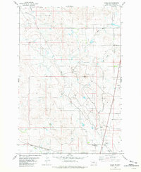
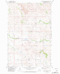
 1957 Miles City1957 Print · USGSEastern Montana and the North Dakota borderlands come alive in the mid-fifties as the rail and ranching economy peaks along the Yellowstone River. Genealogists and historians can trace numerous rural landmarks like St Phillips Church, Fertile Prairie School, and the Ostendorf Ranch.
 - 1958 Map of Miles City
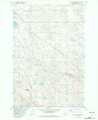
 1958 Miles City1958 Print · USGSEastern Montana ranching and rail life are documented here during the late fifties, centered on the confluence of the Yellowstone River and Powder River. Researchers can trace rural school locations like St Phillips Church and Chimney Creek School alongside dozens of named family ranches.
 - 1958 Map of Ekalaka
 1958 Ekalaka1958 Print · USGSSoutheast Montana in the mid-fifties remains a landscape of isolated ranching outposts and scattered schoolhouses. Genealogists and researchers can trace rural life through landmarks like Belltower, the McClary Ranger Station, and numerous family-named schools such as Davidson School.
 - 1965 Map of Ekalaka
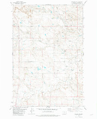
 1965 Ekalaka1965 Print · USGSThe High Plains of Montana and Wyoming appear here in the mid-1950s, as a sprawling landscape of remote ranchlands and rural school districts. Researchers can trace the locations of many small landmarks like Mitchell School, Broadus, and the Humbolt Hills.
 - 1980 Map of Dutchmans Hill
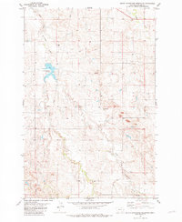
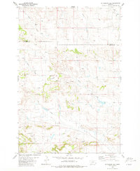 1980 Dutchmans Hill1980 Print · USGSSoutheastern Montana's high plains terrain is captured here during the late twentieth century, showing the border between Fallon and Carter Counties. Researchers can trace the water sources essential to local ranching, from Reynolds Spring to the notable Ice Cave and Dutchmans Hill.
 - 1980 Map of Flasted Hill
 1980 Flasted Hill1980 Print · USGSThe eastern Montana borderlands are documented here in the early eighties, showing the sparsely settled ranching country of Fallon and Carter counties. Local researchers can trace family-named landmarks like Flasted Hill and drainage systems including Squabble Creek and Horse Creek.2 unique versions available
 - 1980 Map of Terrell Creek
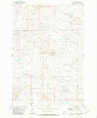
 1980 Terrell Creek1980 Print · USGSSoutheastern Montana's ranching landscape is captured here in the early 1980s, centered on the wooded slopes of the Ekalaka Hills. Researchers can trace old water rights and range history through landmarks like Chimney Rock, Flasted Spring, and Red Hill.
 - 1980 Map of Snider Hill, 1983 Print
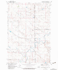 1980 Snider Hill1983 Print · USGSThe tri-state corner of Montana and the Dakotas is captured in the early 1980s, showcasing the high-plains ranching landscape. Trace the winding waters of Boxelder Creek and Coal Bank Creek as they cut between landmarks like Snider Hill and Monument Butte.
 - 1981 Map of Webster NW
 1981 Webster NW1981 Print · USGSFallon County during the early eighties shows a landscape of traditional ranching land meeting a modern energy boom. Researchers can trace the development of the gas industry through dozens of Gas Wells, a Pumping Sta, and the path of Hidden Water Creek.
 - 1981 Map of Baker
 1981 Baker1981 Print · USGSThe Montana-North Dakota borderlands are captured here in the early 1980s, showcasing the high plains ranching and rail corridor. Genealogists can locate rural landmarks like Lame Jones School and the Milwaukee Road railroad route through Plevna and Ismay.
 - 1981 Map of Baker NE
 1981 Baker NE1981 Print · USGSFallon County in the early eighties was a landscape defined by energy production and heavy rail. Genealogists and industrial historians can trace the Chicago Milwaukee St Paul and Pacific rail line and locate the Bonnievale Cem.
 - 1981 Map of Buffalo Reservoir
 1981 Buffalo Reservoir1981 Print · USGSFallon County was a hub of energy production and rail transit in the early eighties. Researchers can trace the extensive Pennel Oil Field infrastructure, the Chicago Milwaukee St Paul and Pacific rail line, and landmarks like Bracket Butte.
 - 1981 Map of Scole School
 1981 Scole School1981 Print · USGSThe Montana and North Dakota border comes alive in the early eighties as a hub of energy production. Genealogists and local historians can trace the footprint of the Little Beaver East Oil Field and find landmarks like Scole Sch and the remote Landing Strip.
 - 1981 Map of Harmon Butte
 1981 Harmon Butte1981 Print · USGSSoutheastern Montana's high plains are captured in the early eighties as a network of drainages and ranch land. Trace the terrain from Harmon Butte down to working landmarks like the Landing Strip, Storage Bins, and the banks of Milk Creek.
 - 1981 Map of Baker
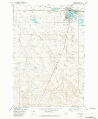 1981 Baker1981 Print · USGSBaker stands at the center of the Fallon County prairie during the early 1980s, serving as a vital hub for the railroad and energy industries. Researchers can trace the legacy of the Pennell Oil Field, locate the St John Cemetery, and see the town's social layout from the Fairground to the High Sch.
 - 1981 Map of South Sandstone Reservoir
 1981 South Sandstone Reservoir1981 Print · USGSFallon County during the early 1980s was a landscape of ranching and resource extraction. Researchers can trace the water levels of South Sandstone Reservoir and locate industrial landmarks like the Pipeline and various Gravel Pits.
 - 1981 Map of Bracket Butte
 1981 Bracket Butte1981 Print · USGSEastern Montana ranching country comes into focus at the Custer and Fallon county line in the early eighties. Genealogists can locate family landmarks such as Cottonwood School, Cottonwood Cemetery, and the Mc Kee Well near Bracket Butte.
 - 1981 Map of Lawrence Creek East
 1981 Lawrence Creek East1981 Print · USGSFallon County, Montana, was a hub of energy production in the early eighties as petroleum exploration reshaped the prairie landscape. Genealogists and industrial historians can trace the network of the Cabin Creek Oil Field and Monarch Field alongside Wills Creek.
 - 1981 Map of Nelson Butte
 1981 Nelson Butte1981 Print · USGSSoutheastern Montana ranching country is documented here in the early eighties at the boundary of Fallon and Carter Counties. Researchers can trace the drainages of O'Fallon Creek and Lone Tree Creek as they wind past Nelson Butte.
 - 1981 Map of Lawrence Creek West
 1981 Lawrence Creek West1981 Print · USGSFallon County, Montana, is captured here in the late seventies, showing a ranching landscape structured around water rights and infrastructure. Researchers can trace the path of a major Pipeline or locate remote water sources such as Pennel Creek, Sprs, and numerous wells.
 - 1981 Map of Willard
 1981 Willard1981 Print · USGSThe high plains of Fallon County are captured in the early eighties, centered on the small settlement of Willard. Researchers can trace the drainage patterns of Hidden Water Creek and Richards Creek alongside landmarks like the Radio Tower and Flowing Well.
 - 1981 Map of Willard SE
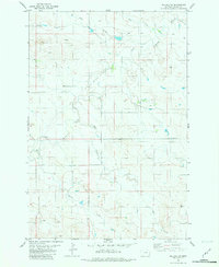 1981 Willard SE1981 Print · USGSFallon County ranchlands are documented here in the early eighties as a network of vital water sources and drainages. Researchers can trace the courses of Little Beaver Creek and Bone Pile Creek while locating remote wells and a Flowing Well.
Showing maps 1-25 of 285
Top cities of Fallon County
Frequently asked questions
- What are the different types of historical maps available for Fallon County?
- What is the oldest map of Fallon County?
- Where can I purchase historical maps of Fallon County for my home or office?
- Where can I download high-res historical maps of Fallon County?
- Are there historical topographic maps available for Fallon County?
- Is there historical aerial imagery available for Fallon County?
- Where are historical maps of Fallon County sourced from?