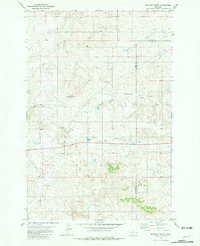
1981 Map of Bracket Butte
USGS Topo · Published 1981About this map
Custer and Fallon counties meet in this high plains landscape dominated by the namesake Bracket Butte. The map documents a rural ranching environment defined by wide drainage networks including Ash Creek and the divergent branches of the North Fork and South Fork Cottonwood Creek. Local communal life is centered around the Cottonwood School and the nearby Cottonwood Cemetery, which provide critical reference points for genealogists researching families from this portion of eastern Montana. The presence of isolated landmarks like Mc Kee Well reflects the essential infrastructure required for livestock operations in this arid region, where water sources like Station Creek and Spring Creek dictated the placement of early improvements and boundary lines.
Find a feature on this map
11 named features on this map. Tap any name to fly to it.
Don’t see what you’re looking for? This feature index may not catch every label — zoom into the map to look around manually.
Map Details
Editions of this 1981 Bracket Butte Map
This is the sole edition of this map. No revisions or reprints were ever made.
Other maps of this area

1953 · Miles City
USGS Topo · 1:250,000

1957 · Miles City
USGS Topo · 1:250,000

1958 · Miles City
USGS Topo · 1:250,000

1969 · Little Whitney Creek
USGS Topo · 1:24,000

1969 · Knowlton
USGS Topo · 1:24,000

1969 · Montague Butte
USGS Topo · 1:24,000

1980 · Terry
USGS Topo · 1:100,000
1980 · Miles City
USGS Topo · 1:100,000

1981 · Baker
USGS Topo · 1:100,000
1981 · Loony Hollow
USGS Topo · 1:24,000