
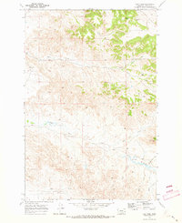
1969 Map of Montague Butte
USGS Topo · Published 1973About this map
Archdale sits at the heart of this Custer County landscape, where the winding course of Locate Creek cuts through the high plains of eastern Montana. Surveyed in the late 1960s, the map reveals a remote ranching territory defined by isolated landmarks and prominent geologic features. The terrain is punctuated by significant elevations like Montague Butte, Twin Buttes, and the long ridge of Henry Woods Mountain, which provide clear orientation points in an area otherwise characterized by vast drainage systems. Small-scale aviation infrastructure is evident with the Leland Landing Strip and another Landing Strip near Coal Creek, highlighting how residents managed the great distances of the Big Sky country. The presence of Roadside Park along the main east-west route suggests a moment of transit through a landscape primarily dedicated to cattle and watershed management, including the headwaters of Whitney Creek and Norton Creek.
Find a feature on this map
17 named features on this map. Tap any name to fly to it.
Don’t see what you’re looking for? This feature index may not catch every label — zoom into the map to look around manually.
Map Details
Editions of this 1969 Montague Butte Map
This is the sole edition of this map. No revisions or reprints were ever made.
Other maps of this area

1953 · Miles City
USGS Topo · 1:250,000

1957 · Miles City
USGS Topo · 1:250,000

1958 · Miles City
USGS Topo · 1:250,000

1969 · Little Whitney Creek
USGS Topo · 1:24,000

1969 · Knowlton
USGS Topo · 1:24,000

1969 · Hogan Creek
USGS Topo · 1:24,000

1969 · Flat Top Butte SW
USGS Topo · 1:24,000
1969 · Red Knob
USGS Topo · 1:24,000

1980 · Terry
USGS Topo · 1:100,000
1980 · Miles City
USGS Topo · 1:100,000