
1969 Map of Little Whitney Creek
USGS Topo · Published 1972About this map
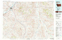
The rolling plains of eastern Montana meet at the administrative divide between Prairie Co and Custer Co, defining a landscape centered on the seasonal drainages of the Missouri River watershed. Rural life in the late 1960s is anchored by the Whitney Creek School, a vital landmark for the scattered ranching community. The drainage of Little Whitney Creek and Court Creek dictate the local topography, with human interventions appearing as modest water management features like Long Dam and a lone Corral situated near the center of the survey area. A straight industrial corridor marked as a Pipeline cuts across the northern terrain, contrasting with the natural wandering paths of the coulees. This survey records a specific moment in the mid-20th century before shifts in rural education and land use transformed the footprint of these high plains homesteads and grazing lands.
Find a feature on this map
9 named features on this map. Tap any name to fly to it.
Don’t see what you’re looking for? This feature index may not catch every label — zoom into the map to look around manually.
Map Details
Editions of this 1969 Little Whitney Creek Map
This is the sole edition of this map. No revisions or reprints were ever made.
Other maps of this area

1953 · Miles City
USGS Topo · 1:250,000

1957 · Miles City
USGS Topo · 1:250,000

1958 · Miles City
USGS Topo · 1:250,000

1969 · Hogan Creek
USGS Topo · 1:24,000

1969 · Montague Butte
USGS Topo · 1:24,000

1969 · Flat Top Butte SW
USGS Topo · 1:24,000

1969 · Flat Top Butte
USGS Topo · 1:24,000

1969 · Flat Top Butte NE
USGS Topo · 1:24,000

1980 · Terry
USGS Topo · 1:100,000
1980 · Miles City
USGS Topo · 1:100,000