
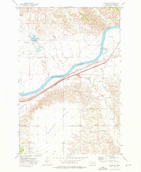
1969 Map of Flat Top Butte
USGS Topo · Published 1973About this map
Flat Top Butte anchors this landscape of eastern Montana, where the terrain is defined by a network of drainage systems cutting through the high plains. The water-scarce environment is evidenced by the prominence of features like Conns Coulee and Ash Creek, which provide the primary topographic relief in an area otherwise marked by gradual elevation changes and wide horizons. This 1969 field-checked survey reveals the subtle traces of human enterprise in Prairie County, including a strategically located Drill Hole and several wells that highlight the search for subsurface resources.
Find a feature on this map
8 named features on this map. Tap any name to fly to it.
Don’t see what you’re looking for? This feature index may not catch every label — zoom into the map to look around manually.
Map Details
Editions of this 1969 Flat Top Butte Map
This is the sole edition of this map. No revisions or reprints were ever made.
Other maps of this area

1953 · Miles City
USGS Topo · 1:250,000

1957 · Miles City
USGS Topo · 1:250,000

1958 · Miles City
USGS Topo · 1:250,000

1966 · Fallon
USGS Topo · 1:24,000

1969 · Little Whitney Creek
USGS Topo · 1:24,000

1969 · Spring Draw
USGS Topo · 1:24,000

1969 · Zero NE
USGS Topo · 1:24,000

1969 · Flat Top Butte SW
USGS Topo · 1:24,000

1969 · Flat Top Butte NE
USGS Topo · 1:24,000
1972 · Fallon SW
USGS Topo · 1:24,000