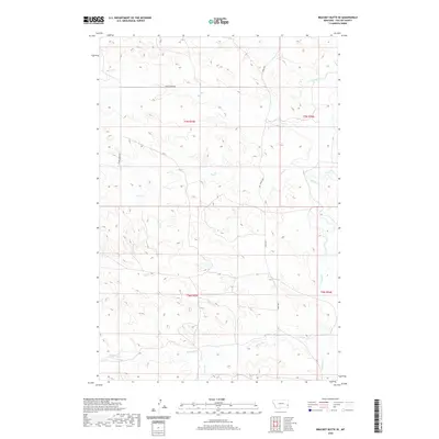
2020 Map of Bracket Butte SE
USGS Topo · Published 2020About this map
O'Fallon Creek and its numerous seasonal tributaries carve a complex drainage pattern across this Fallon County landscape. The area is defined by its rural connectivity, where Spring Creek Rd and Ismay Rd S provide the primary access through the sections of T7N and T6N. Water sources like Spring Cr, Hay Cr, and Miles City Cr dictate the local topography, creating a series of draws and ridges that have long influenced grazing and land use in this part of eastern Montana. The map illustrates a contemporary view of these traditional ranching lands, where Back Cr and other small waterways feed into the larger regional drainage system. The Public Land Survey System grid remains the dominant organizing principle for the territory, marking out the vast open spaces between these essential watercourses.
Find a feature on this map
11 named features on this map. Tap any name to fly to it.
Don’t see what you’re looking for? This feature index may not catch every label — zoom into the map to look around manually.
Map Details
Editions of this 2020 Bracket Butte SE Map
This is the sole edition of this map. No revisions or reprints were ever made.
Other maps of this area

1953 · Miles City
USGS Topo · 1:250,000

1957 · Miles City
USGS Topo · 1:250,000

1958 · Miles City
USGS Topo · 1:250,000

1981 · Baker
USGS Topo · 1:100,000

1981 · Harmon Butte
USGS Topo · 1:24,000
1981 · Bracket Butte
USGS Topo · 1:24,000

1981 · Nelson Butte
USGS Topo · 1:24,000

1981 · Bracket Butte SE
USGS Topo · 1:24,000
1981 · Hooky Dam
USGS Topo · 1:24,000
1981 · Ismay South
USGS Topo · 1:24,000