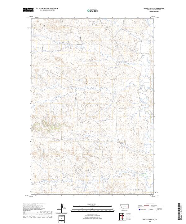
2024 Map of Bracket Butte SE
USGS Topo · Published 2024About this map
O'Fallon Creek meanders through this section of Fallon County, defining a landscape of complex drainages and prairie tablelands. The network of seasonal waterways including Hay Creek, Miles City Creek, and Back Creek illustrates the intricate watershed patterns that have long dictated land use in this part of eastern Montana. Human presence is marked by a sparse but essential grid of rural routes, primarily Spring Creek Rd and Ismay Rd S, which facilitate movement between the disparate sections and ranching blocks. The map provides a clear look at the public land survey system, showing the township and range divisions such as t7n r55e and t6n r56e that underpin property records and local history in this expansive territory.
Find a feature on this map
11 named features on this map. Tap any name to fly to it.
Don’t see what you’re looking for? This feature index may not catch every label — zoom into the map to look around manually.
Map Details
Editions of this 2024 Bracket Butte SE Map
This is the sole edition of this map. No revisions or reprints were ever made.
Other maps of this area

1953 · Miles City
USGS Topo · 1:250,000

1957 · Miles City
USGS Topo · 1:250,000

1958 · Miles City
USGS Topo · 1:250,000

1981 · Baker
USGS Topo · 1:100,000

1981 · Harmon Butte
USGS Topo · 1:24,000
1981 · Bracket Butte
USGS Topo · 1:24,000

1981 · Nelson Butte
USGS Topo · 1:24,000

1981 · Bracket Butte SE
USGS Topo · 1:24,000
1981 · Hooky Dam
USGS Topo · 1:24,000
1981 · Ismay South
USGS Topo · 1:24,000