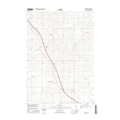
2015 Map of Brackett
USGS Topo · Published 2015About this map
The agrarian landscape of southern Eau Claire County unfolds along the course of Otter Cr, where the small settlements of Brackett, Allen, and Foster serve as local anchors. This modern survey illustrates a rural environment defined by its drainage patterns and township divisions, including t26n r8w and t25n r8w. The topography is marked by distinct depressions such as Kluckman Valley and Fall Creek Valley, which break the regularity of the surrounding section lines. Local genealogy is well-supported by the documentation of community landmarks, particularly the grouping of religious sites and burial grounds such as Saint Johns Cem, Holy Guardian Angels Cem, and Saint Peter Lutheran Cem. The map provides a clear look at the intersection of watercourses like Beaver Cr and Big Cr with the county road network, reflecting the enduring rural character of this Wisconsin interior.
Find a feature on this map
72 named features on this map. Tap any name to fly to it.
Don’t see what you’re looking for? This feature index may not catch every label — zoom into the map to look around manually.
Map Details
Editions of this 2015 Brackett Map
This is the sole edition of this map. No revisions or reprints were ever made.
Other maps of this area

1927 · Strum
USGS Topo · 1:62,500

1930 · Strum
USGS Topo · 1:62,500

1934 · Chippewa Falls
USGS Topo · 1:62,500

1935 · Osseo
USGS Topo · 1:48,000

1936 · Chippewa Falls
USGS Topo · 1:62,500

1940 · Osseo
USGS Topo · 1:62,500

1952 · Cadott
USGS Topo · 1:62,500

1953 · Eau Claire
USGS Topo · 1:250,000

1958 · Eau Claire
USGS Topo · 1:250,000

1964 · Eau Claire
USGS Topo · 1:250,000