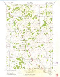
1973 Map of Brackett
USGS Topo · Published 1975About this map
Otter Creek and Beaver Creek wind through this rural landscape in south-central Eau Claire County during the early 1970s. The area shows a transition from traditional agricultural patterns toward modern infrastructure, as evidenced by a prominent pipeline and an Old Railroad Grade that cuts across the township boundaries of Washington, Lincoln, Clear Creek, and Otter Creek. Small rural clusters like Brackett and Foster serve as focal points for the surrounding farmsteads.
Find a feature on this map
28 named features on this map. Tap any name to fly to it.
Don’t see what you’re looking for? This feature index may not catch every label — zoom into the map to look around manually.
Map Details
Editions of this 1973 Brackett Map
This is the sole edition of this map. No revisions or reprints were ever made.
Other maps of this area

1927 · Strum
USGS Topo · 1:62,500

1930 · Strum
USGS Topo · 1:62,500

1934 · Chippewa Falls
USGS Topo · 1:62,500

1935 · Osseo
USGS Topo · 1:48,000

1936 · Chippewa Falls
USGS Topo · 1:62,500

1940 · Osseo
USGS Topo · 1:62,500

1952 · Cadott
USGS Topo · 1:62,500

1953 · Eau Claire
USGS Topo · 1:250,000

1958 · Eau Claire
USGS Topo · 1:250,000

1964 · Eau Claire
USGS Topo · 1:250,000