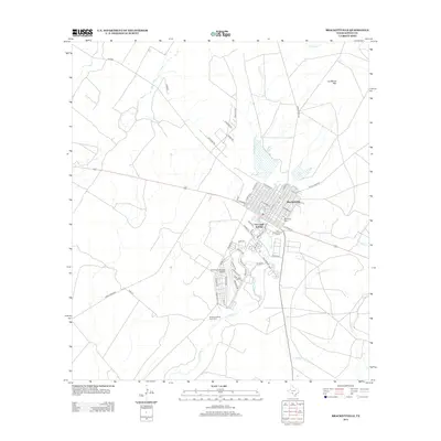
2013 Map of Brackettville
USGS Topo · Published 2013About this map
Brackettville serves as the central hub of this South Texas landscape, where the transition from the Edward's Plateau to the Rio Grande plains is marked by the presence of Las Moras Spring. The water from these springs feeds Las Moras Cr, which flows south past the Fort Clark Historic District. This area retains its layout from its era as a frontier military post, now integrated with modern developments like the Fort Clark Springs Airport. Local history and genealogy are deeply rooted here, evidenced by the Ballantyne Cem and the Seminole Indian Scout Cem, the latter of which reflects the unique cultural heritage of the Black Seminole scouts who served at the fort.
Find a feature on this map
56 named features on this map. Tap any name to fly to it.
Don’t see what you’re looking for? This feature index may not catch every label — zoom into the map to look around manually.
Map Details
Editions of this 2013 Brackettville Map
This is the sole edition of this map. No revisions or reprints were ever made.
Other maps of this area

1896 · Brackett
USGS Topo · 1:125,000

1897 · Brackett
USGS Topo · 1:125,000

1941 · Standart
USGS Topo · 1:62,500

1941 · Tequesquite Creek
USGS Topo · 1:62,500

1943 · Standart
USGS Topo · 1:62,500

1944 · Tequesquite Creek
USGS Topo · 1:62,500

1944 · Spofford
USGS Topo · 1:62,500

1944 · Brackettville
USGS Topo · 1:62,500

1958 · Del Rio
USGS Topo · 1:250,000

1964 · Del Rio
USGS Topo · 1:250,000