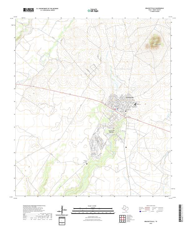
2022 Map of Brackettville
USGS Topo · Published 2022About this map
Brackettville serves as the focal point of this Kinney County landscape, where the town’s grid meets the sprawling grounds of Fort Clark Springs. The map reveals the historic importance of water in this arid region, centering on the Las Moras Spring and the winding course of Las Moras Cr. For genealogists and local historians, the sheet is exceptionally detailed in its documentation of burial grounds, including the Masonic Cem, Kinney County Cem, and the specialized Seminole Indian Scout Cem located south of the main settlement. The geography is dominated by Las Moras Mtn to the northeast, while the built environment features the Kinney County Courthouse and the nearby Fort Clark Springs Airport. A network of ranch-to-market roads like RM 674 and RM 334 connect the community to the surrounding brush country.
Find a feature on this map
79 named features on this map. Tap any name to fly to it.
Don’t see what you’re looking for? This feature index may not catch every label — zoom into the map to look around manually.
Map Details
Editions of this 2022 Brackettville Map
This is the sole edition of this map. No revisions or reprints were ever made.
Other maps of this area

1896 · Brackett
USGS Topo · 1:125,000

1897 · Brackett
USGS Topo · 1:125,000

1941 · Standart
USGS Topo · 1:62,500

1941 · Tequesquite Creek
USGS Topo · 1:62,500

1943 · Standart
USGS Topo · 1:62,500

1944 · Tequesquite Creek
USGS Topo · 1:62,500

1944 · Spofford
USGS Topo · 1:62,500

1944 · Brackettville
USGS Topo · 1:62,500

1958 · Del Rio
USGS Topo · 1:250,000

1964 · Del Rio
USGS Topo · 1:250,000