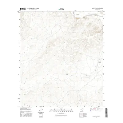
2016 Map of Brackettville NE
USGS Topo · Published 2016About this map
The West Nueces River carves through the northern reaches of this Kinney County landscape, where the seasonal drainage of Leona Draw meets the river's path. This territory is defined by its expansive natural basins and drainage systems, most notably Grass Valley, which sits centrally among the surrounding high ground. The map details a remote Texas environment where transportation is limited to established routes like Rm 334 and Fm 3199, alongside the namesake Tularosa Rd.
Find a feature on this map
11 named features on this map. Tap any name to fly to it.
Don’t see what you’re looking for? This feature index may not catch every label — zoom into the map to look around manually.
Map Details
Editions of this 2016 Brackettville NE Map
This is the sole edition of this map. No revisions or reprints were ever made.
Other maps of this area

1893 · Nueces
USGS Topo · 1:125,000

1896 · Nueces
USGS Topo · 1:125,000

1896 · Brackett
USGS Topo · 1:125,000

1897 · Brackett
USGS Topo · 1:125,000

1938 · Turkey Mountain
USGS Topo · 1:48,000

1943 · Turkey Mountain
USGS Topo · 1:62,500

1944 · Barksdale
USGS Topo · 1:62,500

1944 · Brackettville
USGS Topo · 1:62,500

1944 · Indian Mountain
USGS Topo · 1:62,500

1958 · Del Rio
USGS Topo · 1:250,000