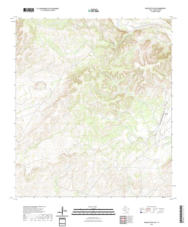
2022 Map of Brackettville NE
USGS Topo · Published 2022About this map
West Nueces River and its tributary W Nueces River carve through the limestone landscape of Kinney County, defining the drainage patterns of this South Texas region. The terrain is marked by seasonal watercourses and topographic depressions like Leona Draw, while the broader expanse of Grass Valley provides a rare area of level ground amidst the dissected plateau. Transportation and infrastructure are concentrated in the eastern portion of the sheet, where FM 3199 provides access to the Tularosa Airport. This facility serves as a vital remote aviation link in the ranchlands north of the Mexican border. Ephemeral streams such as Lindsey Cr underscore the semi-arid character of the environment, where water management and seasonal flow have historically dictated land use and settlement patterns.
Find a feature on this map
7 named features on this map. Tap any name to fly to it.
Don’t see what you’re looking for? This feature index may not catch every label — zoom into the map to look around manually.
Map Details
Editions of this 2022 Brackettville NE Map
This is the sole edition of this map. No revisions or reprints were ever made.
Other maps of this area

1893 · Nueces
USGS Topo · 1:125,000

1896 · Nueces
USGS Topo · 1:125,000

1896 · Brackett
USGS Topo · 1:125,000

1897 · Brackett
USGS Topo · 1:125,000

1938 · Turkey Mountain
USGS Topo · 1:48,000

1943 · Turkey Mountain
USGS Topo · 1:62,500

1944 · Barksdale
USGS Topo · 1:62,500

1944 · Brackettville
USGS Topo · 1:62,500

1944 · Indian Mountain
USGS Topo · 1:62,500

1958 · Del Rio
USGS Topo · 1:250,000