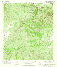
1974 Map of Brackettville NE
USGS Topo · Published 1976About this map
The confluence of the West Nueces River and the Nueces River anchors the northeastern corner of this 1970s landscape in Kinney County. The terrain is defined by deep drainages such as Leona Draw and Elm Creek, which carve through the Edwards Plateau toward the southern plains. While the high ground is dominated by a complex network of ridges, the lower reaches transition into the relatively level Grass Valley.
Find a feature on this map
15 named features on this map. Tap any name to fly to it.
Don’t see what you’re looking for? This feature index may not catch every label — zoom into the map to look around manually.
Map Details
Editions of this 1974 Brackettville NE Map
This is the sole edition of this map. No revisions or reprints were ever made.
Other maps of this area

1893 · Nueces
USGS Topo · 1:125,000

1896 · Nueces
USGS Topo · 1:125,000

1896 · Brackett
USGS Topo · 1:125,000

1897 · Brackett
USGS Topo · 1:125,000

1938 · Turkey Mountain
USGS Topo · 1:48,000

1943 · Turkey Mountain
USGS Topo · 1:62,500

1944 · Barksdale
USGS Topo · 1:62,500

1944 · Brackettville
USGS Topo · 1:62,500

1944 · Indian Mountain
USGS Topo · 1:62,500

1958 · Del Rio
USGS Topo · 1:250,000