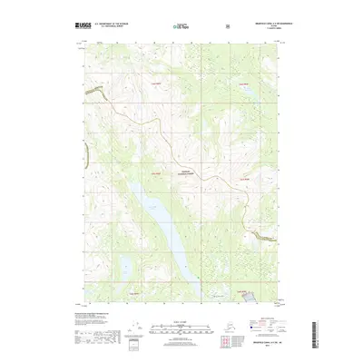
2017 Map of Bradfield Canal A-5 SW
USGS Topo · Published 2017About this map
Tongass National Forest dominates this coastal Alaskan landscape, where glacial waters carve deep into the wilderness. The terrain is defined by a series of significant inland water bodies, including the expansive Reflection Lake and the smaller Little Eagle Lake. These lakes feed into systems like the Eagle River and Short Cr, eventually draining toward the saltwater of Reflection Bay. The map also captures the administrative boundary between Wrangell Borough and Ketchikan Gateway Borough, illustrating how these remote jurisdictions meet amidst high-elevation peaks and dense forest. Further south, Lake Nellie and Lake Rowena offer additional points of interest for those studying the hydrography of the Bradfield Canal region. This survey serves as a precise record of the natural hydrology and topographical contours of the area before modern shifts in glacial runoff might alter these waterways.
Find a feature on this map
18 named features on this map. Tap any name to fly to it.
Don’t see what you’re looking for? This feature index may not catch every label — zoom into the map to look around manually.
Map Details
Editions of this 2017 Bradfield Canal A-5 SW Map
This is the sole edition of this map. No revisions or reprints were ever made.
Other maps of this area

1951 · Bradfield Canal
USGS Topo · 1:250,000

1952 · Ketchikan
USGS Topo · 1:250,000

1952 · Ketchikan D-5
USGS Topo · 1:63,360

1952 · Ketchikan D-6
USGS Topo · 1:63,360

1953 · Ketchikan D-5
USGS Topo · 1:63,360

1953 · Ketchikan D-6
USGS Topo · 1:63,360

1954 · Bradfield Canal
USGS Topo · 1:250,000

1955 · Bradfield canal A-6
USGS Topo · 1:63,360

1955 · Bradfield Canal A-5
USGS Topo · 1:63,360

1955 · Ketchikan
USGS Topo · 1:250,000