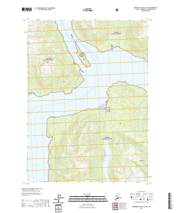
2021 Map of Bradfield Canal A-6 NW
USGS Topo · Published 2021About this map
Tongass National Forest dominates this coastal Alaska landscape, where the waters of Blake Channel and Ernest Sound meet. This survey provides a detailed look at the hydrology of the mainland southeast of Wrangell Island, specifically the drainage system of Anan Cr and the E Fork Anan Cr as they flow into the protected waters of Anan Bay. The map highlights the isolation of Blake Island and the prominent maritime landmark of Point Warde.
Find a feature on this map
15 named features on this map. Tap any name to fly to it.
Don’t see what you’re looking for? This feature index may not catch every label — zoom into the map to look around manually.
Map Details
Editions of this 2021 Bradfield Canal A-6 NW Map
This is the sole edition of this map. No revisions or reprints were ever made.
Other maps of this area

1948 · Petersburg A-1
USGS Topo · 1:63,360

1948 · Petersburg B-1
USGS Topo · 1:63,360

1951 · Bradfield Canal
USGS Topo · 1:250,000

1951 · Petersburg A-1
USGS Topo · 1:63,360

1952 · Petersburg
USGS Topo · 1:250,000

1954 · Bradfield Canal
USGS Topo · 1:250,000

1955 · Bradfield canal A-6
USGS Topo · 1:63,360

1955 · Bradfield canal B-6
USGS Topo · 1:63,360

1955 · Petersburg B-1
USGS Topo · 1:63,360

1955 · Bradfield Canal
USGS Topo · 1:250,000