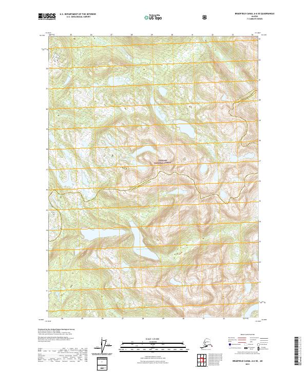
2021 Map of Bradfield Canal A-6 SE
USGS Topo · Published 2021About this map
Halfmoon Lake sits centered in this southeastern Alaskan wilderness, surrounded by the dense reaches of the Tongass National Forest. The landscape is defined by its dramatic glacial topography and the drainage systems of the Anan Cr and its tributary, E Fork Anan Cr, which carve through the high-elevation terrain. This modern survey documents the administrative boundary dividing the Wrangell City and Borough from the Ketchikan Gateway Borough, illustrating how contemporary geopolitical lines intersect with the ancient physical geography of the Alexander Archipelago. The absence of roads or permanent settlements underscores the primitive state of this coastal rainforest environment.
Find a feature on this map
11 named features on this map. Tap any name to fly to it.
Don’t see what you’re looking for? This feature index may not catch every label — zoom into the map to look around manually.
Map Details
Editions of this 2021 Bradfield Canal A-6 SE Map
This is the sole edition of this map. No revisions or reprints were ever made.
Other maps of this area

1951 · Bradfield Canal
USGS Topo · 1:250,000

1952 · Ketchikan
USGS Topo · 1:250,000

1952 · Ketchikan D-5
USGS Topo · 1:63,360

1952 · Ketchikan D-6
USGS Topo · 1:63,360

1953 · Ketchikan D-5
USGS Topo · 1:63,360

1953 · Ketchikan D-6
USGS Topo · 1:63,360

1954 · Bradfield Canal
USGS Topo · 1:250,000

1955 · Bradfield canal A-6
USGS Topo · 1:63,360

1955 · Bradfield Canal A-5
USGS Topo · 1:63,360

1955 · Ketchikan
USGS Topo · 1:250,000