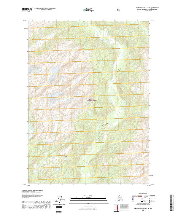
2021 Map of Bradfield Canal B-5 SE
USGS Topo · Published 2021About this map
Tongass National Forest dominates this Alaskan landscape, where steep coastal mountains and deep glacial valleys define the wilderness of the N Fork Bradfield River. The river winds through the central corridor of the quadrangle, flanked by sharp topographic rises that reach several thousand feet in elevation. This 2021 edition reflects the preserved state of the Wrangell region, showing a landscape devoid of permanent settlements or modern road infrastructure. The map provides a detailed view of the natural drainage patterns and the complex contours of the northern rainforest, serving as a primary reference for the intricate hydrology of the N Fork Bradfield River basin before it reaches the Bradfield Canal.
Find a feature on this map
8 named features on this map. Tap any name to fly to it.
Don’t see what you’re looking for? This feature index may not catch every label — zoom into the map to look around manually.
Map Details
Editions of this 2021 Bradfield Canal B-5 SE Map
This is the sole edition of this map. No revisions or reprints were ever made.
Other maps of this area

1951 · Bradfield Canal
USGS Topo · 1:250,000

1954 · Bradfield Canal
USGS Topo · 1:250,000

1955 · Bradfield canal A-4
USGS Topo · 1:63,360

1955 · Bradfield canal B-5
USGS Topo · 1:63,360

1955 · Bradfield canal B-4
USGS Topo · 1:63,360

1955 · Bradfield Canal A-5
USGS Topo · 1:63,360

1955 · Bradfield Canal
USGS Topo · 1:250,000
1995 · Bradfield Canal A-4
USGS Topo · 1:63,360
2017 · Bradfield Canal B-5 SW
USGS Topo · 1:25,000
2017 · Bradfield Canal A-4 NW
USGS Topo · 1:25,000