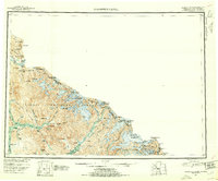
1951 Map of Bradfield Canal
USGS Topo · Published 1953About this map
The Bradfield Canal and the Stikine River define this coastal reach of Southeast Alaska during the mid-twentieth century. Most of the territory is encompassed by the Tongass National Forest, stretching from the jagged peaks of the British Columbia Alaska border to the complex network of inlets and fjords. The landscape is dominated by high summits such as Mt Whipple and Mt Tyee, which overlook a series of substantial glacial features and high-altitude lakes like Tyee Lake.
Find a feature on this map
89 named features on this map. Tap any name to fly to it.
Don’t see what you’re looking for? This feature index may not catch every label — zoom into the map to look around manually.
Map Details
Editions of this 1951 Bradfield Canal Map
3 editions found
Other maps of this area

1948 · Petersburg A-1
USGS Topo · 1:63,360

1948 · Petersburg C-1
USGS Topo · 1:63,360

1948 · Petersburg B-1
USGS Topo · 1:63,360

1949 · Craig D-1
USGS Topo · 1:63,360

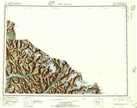
1951 · Bradfield Canal
USGS Topo · 1:250,000

1951 · Craig D-1
USGS Topo · 1:63,360

1951 · Petersburg A-1
USGS Topo · 1:63,360

1952 · Petersburg
USGS Topo · 1:250,000

1952 · Ketchikan
USGS Topo · 1:250,000

1952 · Sumdum
USGS Topo · 1:250,000