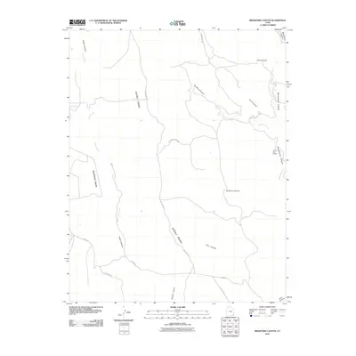
2010 Map of Bradford Canyon
USGS Topo · Published 2010About this map
Three Kiva Pueblo stands as a significant landmark in this San Juan County landscape, situated near the eastern edge of the quadrangle where Montezuma Creek carves through its namesake Montezuma Canyon. This 2010 survey illustrates a high desert environment dominated by deep drainages and expansive plateaus, including Mustang Mesa and the prominent ridge of Alkali Point. The land is networked by a series of rural roads and tracks such as Perkins Rd and Dead Man Canyon Rd, which navigate around rugged breaks like Deadman Canyon and Bradford Canyon. Agricultural and pastoral infrastructure is sparse but present, evidenced by the Alkali Windmill located in the southwestern corner, providing a vital water source in this arid terrain. The map's detail helps trace the topography of the many small canyons, including Cave Canyon and Devil Canyon, that feed into the larger creek systems.
Find a feature on this map
19 named features on this map. Tap any name to fly to it.
Don’t see what you’re looking for? This feature index may not catch every label — zoom into the map to look around manually.
Map Details
Editions of this 2010 Bradford Canyon Map
This is the sole edition of this map. No revisions or reprints were ever made.
Other maps of this area

1886 · Abajo
USGS Topo · 1:250,000

1892 · Abajo
USGS Topo · 1:250,000

1893 · Abajo
USGS Topo · 1:250,000

1955 · Verdure 4 NW
USGS Topo · 1:24,000

1955 · Verdure 3 SE
USGS Topo · 1:24,000

1955 · Verdure 4 SW
USGS Topo · 1:24,000

1955 · Verdure 3 NE
USGS Topo · 1:24,000

1956 · Cortez
USGS Topo · 1:250,000

1957 · Aneth 1 NW
USGS Topo · 1:24,000

1957 · Monument Canyon
USGS Topo · 1:62,500