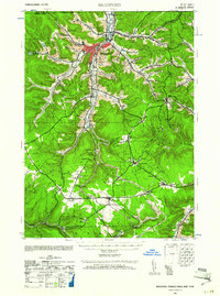
1941 Map of Bradford
USGS Topo · Published 1961About this map
Bradford serves as the industrial and population hub of this 1941 survey, showing a dense network of streets and structures concentrated along the valley where Tuna Creek meets Foster Brook. The surrounding McKean County landscape is defined by its deep hollows and narrow ridges, such as Hedgehog Hollow and Gates Hollow, which dictated the winding paths of the railroads. The Pennsylvania, Erie, and Baltimore and Ohio rail lines create a complex transport corridor through the hills, connecting smaller settlements like Custer City and Lewis Run.
Find a feature on this map
89 named features on this map. Tap any name to fly to it.
Don’t see what you’re looking for? This feature index may not catch every label — zoom into the map to look around manually.
Map Details
Editions of this 1941 Bradford Map
2 editions found

Other maps of this area

1898 · Olean
USGS Topo · 1:62,500

1900 · Salamanca
USGS Topo · 1:62,500

1922 · Randolph
USGS Topo · 1:62,500

1923 · Randolph
USGS Topo · 1:62,500

1924 · Bradford
USGS Topo · 1:62,500

1926 · Bradford
USGS Topo · 1:62,500

1933 · Smethport
USGS Topo · 1:62,500

1934 · Kane
USGS Topo · 1:48,000

1935 · Mt. Jewett
USGS Topo · 1:48,000

1936 · Kinzua
USGS Topo · 1:48,000