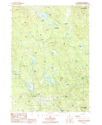
1987 Map of Bradford
USGS Topo · Published 1987About this map
The town of Bradford serves as a focal point for this late 20th-century survey of Merrimack County, where the landscape is defined by its glacial lakes and the winding course of the Warner River. The map captures the rural character of the region as it appeared in the 1980s, documenting clustered settlements like South Sutton, North Sutton, and the small community at Melvin Mills. The abundance of water bodies, including Kezar Lake, Blaisdell Lake, and Lake Massasecum, illustrates a geography dominated by recreation and conservation.
Find a feature on this map
62 named features on this map. Tap any name to fly to it.
Don’t see what you’re looking for? This feature index may not catch every label — zoom into the map to look around manually.
Map Details
Editions of this 1987 Bradford Map
This is the sole edition of this map. No revisions or reprints were ever made.
Other maps of this area

1902 · Sunapee
USGS Topo · 1:62,500

1905 · Sunapee
USGS Topo · 1:62,500

1907 · Sunapee
USGS Topo · 1:62,500

1926 · Hillsboro
USGS Topo · 1:62,500

1928 · Mount Kearsarge
USGS Topo · 1:62,500

1929 · Hillsboro
USGS Topo · 1:62,500

1930 · Lovewell Mountain
USGS Topo · 1:62,500

1931 · Mount Kearsarge
USGS Topo · 1:62,500

1942 · Lovewell Mountain
USGS Topo · 1:62,500

1949 · Portland
USGS Topo · 1:250,000