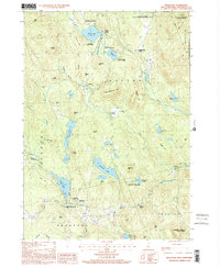
1998 Map of Bradford
USGS Topo · Published 2001About this map
Lake Massasecum and the surrounding cluster of glacial lakes define this pocket of Merrimack County during the late 20th century. The settlement at Bradford serves as a local hub, situated where the Warner River begins its eastward flow toward Melvin Mills. The landscape is a dense network of water bodies and hills, with Blaisdell Lake, Todd Lake, and Kezar Lake anchoring the recreation and conservation efforts in the region.
Find a feature on this map
69 named features on this map. Tap any name to fly to it.
Don’t see what you’re looking for? This feature index may not catch every label — zoom into the map to look around manually.
Map Details
Editions of this 1998 Bradford Map
This is the sole edition of this map. No revisions or reprints were ever made.
Other maps of this area

1902 · Sunapee
USGS Topo · 1:62,500

1905 · Sunapee
USGS Topo · 1:62,500

1907 · Sunapee
USGS Topo · 1:62,500

1926 · Hillsboro
USGS Topo · 1:62,500

1928 · Mount Kearsarge
USGS Topo · 1:62,500

1929 · Hillsboro
USGS Topo · 1:62,500

1930 · Lovewell Mountain
USGS Topo · 1:62,500

1931 · Mount Kearsarge
USGS Topo · 1:62,500

1942 · Lovewell Mountain
USGS Topo · 1:62,500

1949 · Portland
USGS Topo · 1:250,000