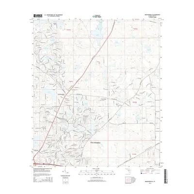
2015 Map of Bradfordville
USGS Topo · Published 2015About this map
Lake Iamonia and the surrounding wetlands of Leon County dominate the northern reaches of this landscape, just as the northward expansion of Tallahassee begins to define the southern boundary. The area around Bradfordville and Centerville reflects a transition from rural Florida acreage to modern residential development, yet it preserves deep ties to its past through family and community landmarks. Researchers can locate several quiet burial grounds, including the Bradford-Eppes Cem and Lester Cem, which sit near the intersection of historic corridors. The map is particularly notable for its dense concentration of small, named water bodies such as Lake Monkey Business, Petty Gulf Lake, and Lake Tom John. This high-resolution survey captures the intricate network of suburban roads like Bannerman Rd as they weave between established points like Mitchell Point and modern neighborhoods near Lake Killarney.
Find a feature on this map
237 named features on this map. Tap any name to fly to it.
Don’t see what you’re looking for? This feature index may not catch every label — zoom into the map to look around manually.
Map Details
Editions of this 2015 Bradfordville Map
This is the sole edition of this map. No revisions or reprints were ever made.
Other maps of this area

1940 · Tallahassee
USGS Topo · 1:62,500

1942 · Tallahassee
USGS Topo · 1:62,500

1943 · Tallahassee
USGS Topo · 1:62,500

1954 · Lloyd
USGS Topo · 1:24,000

1954 · Lafayette
USGS Topo · 1:24,000

1954 · Tallahassee
USGS Topo · 1:250,000

1956 · Calvary
USGS Topo · 1:24,000

1957 · Beachton
USGS Topo · 1:24,000

1957 · Miccosukee NE
USGS Topo · 1:24,000

1959 · Tallahassee
USGS Topo · 1:250,000